


1-Voting District, Hernando County, Florida
About
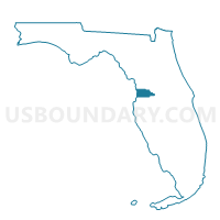
Outline

Summary
| Unique Area Identifier | 553492 |
| Name | 1-Voting District |
| County | Hernando County |
| State | Florida |
| Area (square miles) | 27.69 |
| Land Area (square miles) | 27.26 |
| Water Area (square miles) | 0.42 |
| % of Land Area | 98.47 |
| % of Water Area | 1.53 |
| Latitude of the Internal Point | 28.62648820 |
| Longtitude of the Internal Point | -82.29198220 |
Maps


Graphs
Select a template below for downloading or customizing gragh for 1-Voting District, Hernando County, Florida


Neighbors
Neighoring Voting District (by Name) Neighboring Voting District on the Map
- 2-Voting District, Hernando County, FL
- 37-Voting District, Hernando County, FL
- 402-Voting District (Indian Hill Baptist Church), Sumter County, FL
- 407-Voting District (Croom-A-Coochee Fire Station), Sumter County, FL
- 408.3-Voting District, Citrus County, FL
- 6-Voting District, Hernando County, FL
- 7-Voting District, Hernando County, FL
Top 10 Neighboring County Subdivision (by Population) Neighboring County Subdivision on the Map
- Inverness CCD, Citrus County, FL (70,297)
- Brooksville CCD, Hernando County, FL (32,838)
- Bushnell-Center Hill CCD, Sumter County, FL (25,287)
- Ridge Manor CCD, Hernando County, FL (6,882)
Top 10 Neighboring Place (by Population) Neighboring Place on the Map
Top 10 Neighboring Unified School District (by Population) Neighboring Unified School District on the Map
- Hernando County School District, FL (172,778)
- Citrus County School District, FL (141,236)
- Sumter County School District, FL (93,420)
Top 10 Neighboring State Legislative District Lower Chamber (by Population) Neighboring State Legislative District Lower Chamber on the Map
Top 10 Neighboring State Legislative District Upper Chamber (by Population) Neighboring State Legislative District Upper Chamber on the Map
Top 10 Neighboring 111th Congressional District (by Population) Neighboring 111th Congressional District on the Map
Top 10 Neighboring Census Tract (by Population) Neighboring Census Tract on the Map
- Census Tract 402.02, Hernando County, FL (6,242)
- Census Tract 401.01, Hernando County, FL (4,785)
- Census Tract 9106.01, Sumter County, FL (4,709)
- Census Tract 4513, Citrus County, FL (3,306)
- Census Tract 9106.02, Sumter County, FL (2,764)
- Census Tract 402.01, Hernando County, FL (2,681)
- Census Tract 406.01, Hernando County, FL (2,525)
Top 10 Neighboring 5-Digit ZIP Code Tabulation Area (by Population) Neighboring 5-Digit ZIP Code Tabulation Area on the Map
- 34601, FL (22,336)
- 33513, FL (12,086)
- 33597, FL (8,026)
- 34436, FL (7,938)
- 34602, FL (7,346)
- 34661, FL (297)